Aug. 24, 2014 -- Bryce Canyon National Park:
With
the 1 hour time difference between STL and St. George, we took
advantage of waking up early and decided to head to Bryce Canyon our 1st
full day there. It's about 145 miles from St. George, but a lot of it
was on 2 lane highways so took about 3 hours to get there. I even
enjoyed the ride there. Certainly different landscape then we have back
home!
haven't seen an 80mph speed limit in awhile, either!
one of the many farms along the way
Before we even got to Bryce we were given hints of what was to come.
Finally got to the relatively small, 56.2 square miles, Bryce Canyon National Park.
Ken
had just gotten his Senior National Parks Pass (or whatever they call it
now), so we didn't have to pay the $25 entrance fee. This card came in
quite handy throughout our 3 week trip. Quite a deal at $10 for USA
residents over 62 years old.
By
now we were hungry so we drove straight to the lodge hoping to get
breakfast. Unfortunately they quit serving breakfast and closed for
about 1 1/2 hours at 10am. We got there right at 10. So we were
directed to a cafe next to the lodge were we grabbed a snack to hold us
over until lunch. A very inquisitive chipmunk even decided to try and
help me with my yogurt. But I heeded all the signs saying not to feed
the wildlife and wouldn't share with him.
Now
it was time to walk a bit of the trails. I wasn't in the best of
shape for a 3 week vacation to a lot of national parks, but I was going
to see them even if I had to crawl, damn it! First up---Sunrise Point
at an elevation of 8,015'.
Close ups---
Sunrise
Point serves as the trailhead for the easy to moderate Queen's Garden
Trail that descends into a section of hoodoos ruled by the Queen
Victoria hoodoo. This viewpoint also represents the end point for the
Navajo Loop/Queen Victoria combination, one of the most popular hikes in
the Park. The full hike is 8 miles, but there is a shortened hike
descending this section of the Fairyland Loop as far as the Tower Bridge
and returning back up to Sunrise point which offers a 3-mile "out and
back." It's listed as moderate, but with my leg situation and having
enough trouble breathing at 8,000', we elected not to hike down and
back. I understand there are slot canyons along that trail which I
really wanted to see, but couldn't risk it with my bum leg. Maybe next
time!
Perhaps this would have been a more interesting way to "hike" the canyon?!
loved all the wildlife throughout the park, too.
At
Bryce Canyon, hoodoos range in size from that of an average human to
heights exceeding a 10-story building. Formed in sedimentary rock,
hoodoo shapes are affected by the erosion patterns of alternating hard
and softer rock layers. The name given to the rock layers that form
hoodoos at Bryce Canyon is the Claron Formation. This layer has several
rock types including siltstones and mudstones but is predominately
limestone. Thirty to 40 million years ago this rock was "born" in an
ancient lake that covered much of Western Utah. Minerals deposited
within different rock types cause hoodoos to have different colors
throughout their height.
Nowhere in the world are hoodoos as abundant as in the northern section of Bryce Canyon National Park.
White-breasted Nuthatch
Steller's Jay--a relative of the Blue Jay.
After
our hour or so walk around the Sunrise Point area, we walked back to
the parking lot and decided to take the free shuttle/tour that goes to
the "high lights" of the park. We rode it almost all the way around
(having to change buses at the entrance) and then got off at the Lodge
for lunch.
The Lodge was built between 1924 and 1925 using local
materials. It's the only remaining completely original lodge designed
by Underwood for Bryce, Zion, and the North Rim of the Grand Canyon.
Passing the lobby along the way to the dining room.
and the huge lobby fireplace
Lunch
was worth the wait. We elected to have the hot/cold buffet and weren't
disappointed. They had all sorts of salad makings, cheeses, lunch
meats, breads, soups, a pasta, and sloppy joe and pulled pork on the
buffet---all for about $15. It was very good.
After lunch, we rode the bus back to our car at Sunrise Point, then
drove the route the bus took. Our first stop was at Bryce Point. The
canyon's namesake, Ebenezer Bryce, settled in the valley just below the
canyon in 1870. Bryce was a shipbuilder who journeyed west with Brigham
Young and the Mormon pioneers to assist in the construction of
buildings. He only lived there 5 years during which time he constructed
roads for transporting lumber and surveyed the route for a 10-mile
irrigation ditch from the top of the plateau to the valley that would
later lead to larger, more permanent settlements.
This condensed picture is actually about a 220 degrees view of Bryce Canyon.
Would love to have seen the view from this helicopter!
There
is a short walk from the parking lot to Bryce Point which overlooks the
huge amphitheater known as Bryce Canyon. Bryce Canyon is not a
"real" canyon. It's not carved by flowing water, but by "frost-wedging"
and naturally acidic rain water.
Here's the section to the left as we approached the point. The white area to the far left was full of grottos.
Close
up of the grottos which are the result of erosion of softer pockets of
the upper White Member of the Claron Formation. This section of
limestone is purer; its lack of color is caused by the absence of
mineral impurities.
We assume the concrete looking stuff here is actually a conglomerate stone which takes longer to dissolve.
selfie time!
Close up of the hoodoo layers.
Another view of the grottos area.
Our next stop was Inspiration Point.
The
viewpoint at Inspiration Point consists of three levels that provide
varied spectacular perspectives of the main amphitheater. We apparently only saw the perspective from this level.
Next on our route was Sunset Point---not too far from Sunrise Point.
Iron
oxide minerals supply the vibrant red, oranges, and yellows of the
lower half of the cliffs which geologists call the Pink Member.
Many trees along the Rim Trail between Sunset and Sunrise Points are
dying because much of their root systems are completely exposed after
human foot traffic has compacted and worn away the soil.
The
Navajo Loop Trail descends from Sunset Point through the slot canyon of
Wall Street, where 500 to 700-year-old Douglas Firs reach upward toward
the sunlight at the top of the canyon. The Navajo Loop is the most
popular trail in the park, and is often combined with the Queen's Garden
Trail that emerges onto the rim at Sunrise Point.
A close up of a couple hoodoos from Sunset Point
Another closeup from Sunset Point.
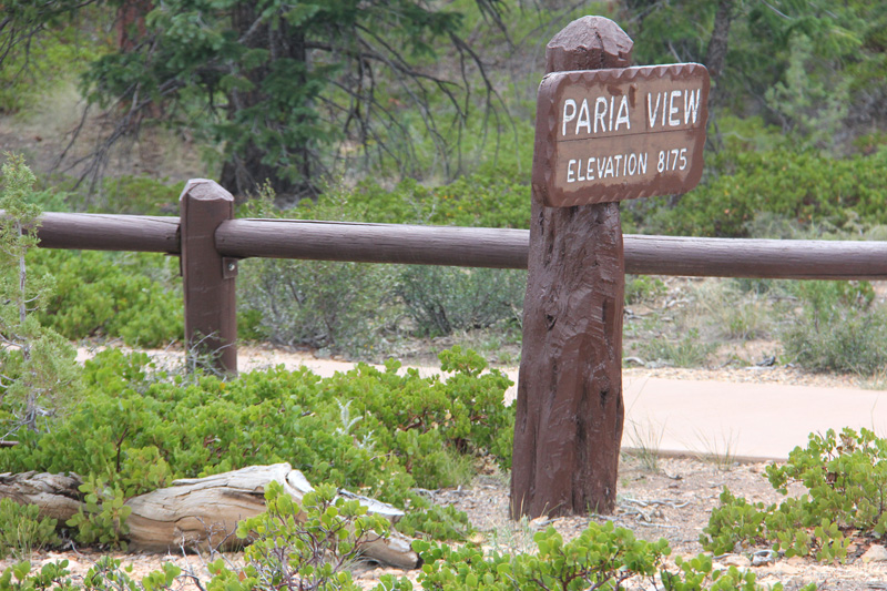
Named after the Paria River watershed, this area is known for it's slot
canyons. Not a good place to be during heavy rains, though.
Most
of the park is shaded at sunset, but this one is suppose to have
hoodoos raising high enough to catch the last rays of the sun.
Quite beautiful in full sunlight, too!
Just some more hoodoos.
Don't know what kind of bird this is, but he was running around the parking lot.
On a clear day, you can see up to 160 miles away from here!
It was a pretty clear day, so I assume we were seeing into Arizona---some 90 miles away.
Natural Bridge--this viewpoint is close to a natural bridge (thus the name), the only one we saw here at Bryce.
Near
the parking lot here is a "clone" of Quaking Aspens. Aspen "clones,"
as the individual root systems are called, can live to be thousands of
years old by reproducing from it's extensive root system. They were
going dormant throughout the park until prescribed fires were started
to burn away some spruce and fir forests that shaded them out. The
fires allow the dormant aspen to quickly return. Unlike most trees,
they have a green layer under their white bark that continues to
synthesize sugars during winter and provide food for deer and elk. Plus
just seeing the white bark in contrast to the colors of the rocks is
pretty awesome.
Some more of the wild flowers growing all around the park.
Even saw some of the Paintbrush variety near one parking lot.
Agua Canyon
One of the 2 prominent hoodoos seen here.
another view with yellow wildflowers in the foreground.
The other prominent hoodoo here at Ague.
Ponderosa Point
Raven posing for his close up.
Ponderosa Canyon got it's named because of the huge Ponderosa Pines on the canyon floor.
Some of these trees measure more than 5 ft. in diameter and over 150' tall, but you can't tell that from this viewpoint.
another viewpoint of Ponderosa Canyon
Back on the road----
Up to the highest point---Rainbow Point.
Here is one of the places you can get a good look at the sequence of
rock layers in the Grand Staircase, which encompasses 1.9 million acres .
The sections or steps in the Grand Staircase are named for the dominant
color of rock. The best view of this is from the viewpoint Yovimpa
Point. Not knowing this at the time and it already being after 6pm, I
just made it to the first viewpoint. But you can sort of see the Grand
Staircase here-- the top step is known as the Pink Cliffs. Directly
below that are the Grey Cliffs, then the White Cliffs. Looking down into
distant canyons near the horizon are some red rock underneath the White
Cliffs. This red rock makes up the Vermilion Cliffs. Hidden from view
but directly under the towering Vermilion Cliffs are the comparatively
diminutive Chocolate Cliffs. The tree-covered hills that meet the
horizon belong to the Kaibab Plateau — the North Rim of the Grand
Canyon.
Another view from Rainbow Point.
and another with the North Rim of the Grand Canyon off in the distance.
trees along our drive back towards the entrance.
Along
the side of the road we even came upon some Pronghorns. They were
reintroduced into the area after practically being eliminated in the
late 1800s and early 1900s.
Looks like the remnants of one of those prescribed fires behind the Pronghorns.
They were so cute I had to include 3 pictures of them.
Before
heading out of the park, we decided to run over to Bryce Point again.
Even with the sun dipping low, it was still beautiful!
From the walkway heading to the viewpoint.
a view of the viewpoint from the walkway.
One last view from the point.
It
was after 7 by the time we left the park. It was a full day, just wish
we had been able to hike more of the trails. But after spending about
10 hours in the park, we really wouldn't have had time to hike more and
still see all that we did!
Nearing sunset during our 3 hour ride back to St. George.
So glad we finally got to go here! It was spectacular!


No comments:
Post a Comment